septiembre 20, 2024
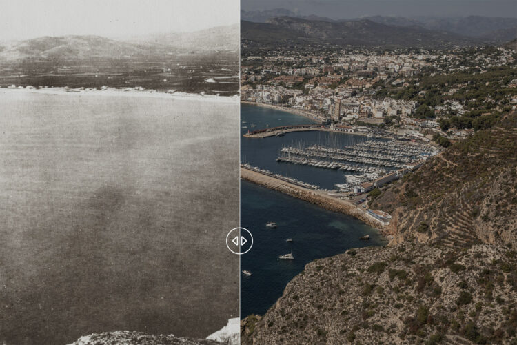
This comparison shows Portixol Island, located in the municipality of Jávea, in the north of the Spanish province of Alicante on the Mediterranean coast, in a photograph taken at the beginning of the 20th century (exact year unknown) and another taken in August 2024.
On the coast facing the island, we can observe the disappearance of farmland, replaced by forest mass. Most experts agree a major risk factor driving extreme wildfires is forest continuity. In terms of mega fire risk, uninterrupted and unmanaged forest areas are an enemy hidden in plain sight.
Portixol Island was declared a protected area in 2016 due to its archaeological, cultural, natural, and ethnographic importance. This means that authorizations are required for any activity on the island.
To learn more about forest continuity and its relationship with mega fires on the Iberian Peninsula, you can visit our report Fuelling a Mega Fire.
Credits
- 1900: Jávea Municipal Archive
- 2024: Santi Palacios for Sonda Internacional